Wild & Scenic Segments

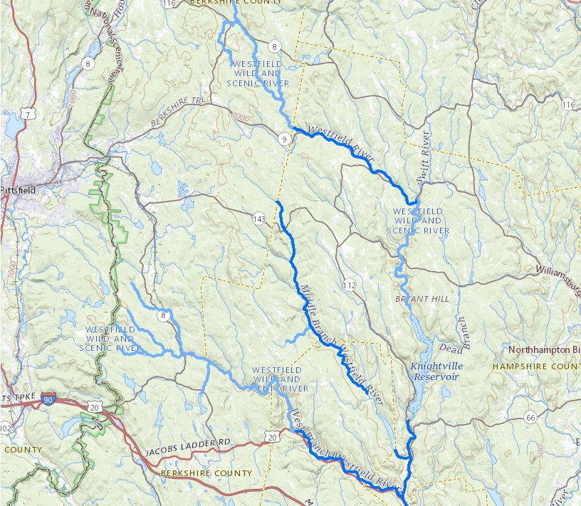
The Westfield River Wild and Scenic designation stretches over 78.1 miles along the Main Stem, East Branch, Middle Branch and West Branch of the Westfield River. The corridor width is 200 feet wide from mean high water, corresponding to the width of the Massachusetts River Protection Act.

Dark Blue = Designated in 1993

Light Blue = Designated in 2004

Designated National Wild & Scenic segments include:

  • West Branch and Headwater Tributaries
    • Shaker Mill Brook from its headwaters in October Mountain State Forest in Washington to its confluence with Depot Brook in Becket
    • Depot Brook from its headwaters near Beach Road in Washington to the confluence with Shaker Mill Brook in Becket
    • Savery Brook from the headwaters off Pittsfield Road in Washington to the confluence with Shaker Mill Brook
    • Watson Brook from the headwaters off Stanley Road in Washington to the confluence with Shaker Mill Brook
    • Center Pond Brook from Center Pond to its confluence with the West Branch in Becket
    • The West Branch from the confluence of Shaker Mill Brook and Depot Brook in North Becket Village to confluence with the East Branch in Huntington
  • Middle Branch and Tributaries
    • The Middle Branch from the Peru/Worthington town line downstream to the confluence with Kinne Brook in Chester
    • Glendale Brook from Clark Wright Road bridge to its confluence with the Middle Branch
    • Lower Middle Branch from the Goss Hill Road Bridge downstream to the confluence with the East Branch
  • East Branch and Tributaries
    • Drowned Land Brook from its headwaters in Windsor to the confluence with the East Branch in Savoy
    • Center Brook from its headwaters below a pond near Savoy Center to its confluence with the East Branch
    • The East Branch from the confluence of Drowned Land Brook and Center Brook in Savoy to a point 0.8 miles upstream of the confluence with Holly Brook in Chesterfield.
    • Windsor Jambs Brook from the junction of Phelps Brook and Clear Brook to its confluence with the East Branch in Windsor
    • The Lower East Branch from Sykes Brook in Huntington to the confluence with the West Branch
  • Main Stem from the confluence with the East Branch and Middle Branch in Huntington Center downstream until the Huntington/Russell town line